Caribbean vs Atlantic Coast: Which Side of the Dominican Republic Suits Your Trip?
How the DR's two seas differ in water, waves, sargassum, seasons, airports and atmosphere, and which regions sit on each side
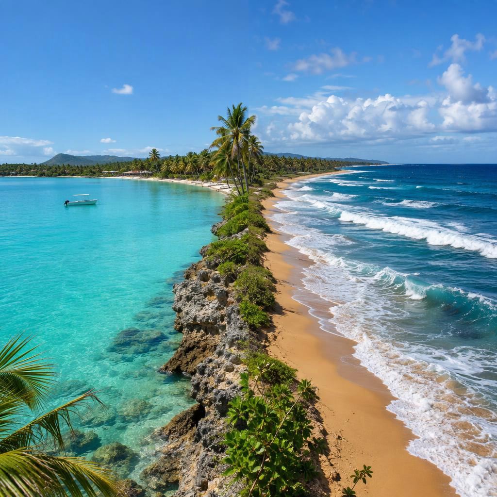
The Dominican Republic sits between two seas. The Caribbean washes the whole south coast, from the Haitian border at Pedernales to La Romana. The Atlantic runs along the whole north coast, from Montecristi to the Samaná Peninsula. At the eastern tip, around Punta Cana, the two meet.
Which side you choose shapes almost everything about a beach trip: how calm the water is, whether you will see waves or whales, how much sargassum to expect in summer, which airport you fly into and what the towns feel like. This guide lays out the differences and points you to the regions and beaches on each side.
The short version: Choose the Caribbean coast (La Romana & Bayahíbe, Santo Domingo, Barahona & Pedernales) for calm, clear water, island boat trips and less sargassum. Choose the Atlantic coast (Puerto Plata, Samaná, Montecristi, Miches) for surf, kite, wild beaches, green mountains and winter whales. Punta Cana on the east tip gives you reef-calmed water and the biggest choice of resorts, with more summer sargassum than either side.
Which regions are on which coast
| Region | Coast | Faces | Main airport |
|---|---|---|---|
| La Romana & Bayahíbe | Caribbean | South | LRM or PUJ |
| Santo Domingo, Boca Chica & Juan Dolio | Caribbean | South | SDQ |
| Barahona & Pedernales | Caribbean | South and south-west | SDQ |
| Punta Cana & Bávaro | Where the two meet | East | PUJ |
| Miches & Costa Esmeralda | Atlantic, inside Samaná Bay | North | PUJ |
| Samaná Peninsula | Atlantic and Samaná Bay | North and south | AZS or SDQ |
| Puerto Plata, Sosúa & Cabarete | Atlantic | North | POP |
| Montecristi & Punta Rucia | Atlantic | North and north-west | STI or POP |
Two regions blur the line. Samaná is a peninsula, so its northern beaches like Playa Cosón and Playa El Valle face open Atlantic, while Cayo Levantado sits in the calm bay on the south side. Miches faces north but sits inside Samaná Bay, so it gets bay water rather than the full force of the open ocean.
The water
Caribbean side. This is the water most people picture: clear, turquoise and usually flat. The south-east around Bayahíbe is the calmest stretch in the country. Bayahíbe Beach and Playa Dominicus are calm most days, and the islands of the Parque Nacional del Este, Isla Saona and Isla Catalina, have some of the clearest water and best snorkeling on the island. Near the capital, Boca Chica is a reef-protected lagoon shallow enough to wade across.
Atlantic side. The water here is often deeper blue and livelier. Bays and coves can be lovely to swim in, like Sosúa Beach, Playa Caletón or Playa La Ensenada, but long open beaches like Playa Grande or Playa Dorada see waves and currents. Rivers draining off the mountains can cloud the water near their mouths after heavy rain, which you will notice at Playa Esmeralda and in Montecristi’s bay.
The east tip. Punta Cana is the hybrid. Its beaches face east, but an offshore reef breaks the Atlantic swell, which is why Bávaro Beach is calm with a gentle entry. The one place in the area with no reef, Macao Beach, shows what the open ocean does here: real surf and rip currents.
Sand. White to pale sand is the norm in Punta Cana, Bayahíbe, Saona and Bahía de las Águilas. The Atlantic beaches range from pale (Playa Rincón, Playa Esmeralda) to golden (Playa Dorada, Playa Grande). Darker sand appears at Playa El Morro and on the San Cristóbal beaches west of Santo Domingo. The Barahona coast is mostly stones and pebbles.
Waves and currents
The single biggest difference between the two coasts is the swell.
Atlantic. From about December to March, north swells roll in and bring bigger waves and rip currents to open beaches. That is great news for surfers at Encuentro Beach, Playa Preciosa and the surf end of Playa Bonita, and a reason for families to pick sheltered beaches in winter. From about June to August the Atlantic is usually at its calmest. Wind is part of the picture too: Cabarete’s Kite Beach has its most reliable wind from June to August, and Playa Buen Hombre in the north-west from about April to September.
Caribbean. Most of the south coast is calm year-round, with light chop on windy afternoons. There are two exceptions worth knowing. The stone beaches of the Barahona coast, such as Playa San Rafael, Playa Paraíso and Playa Los Patos, can have strong waves and undertow, so swim in the river pools instead. And a few south-facing beaches pick up swell: Playa Caribe is a surf cove, and Playa Najayo has stronger waves at times.
Lifeguards are rare on both coasts outside resort beaches. Respect red flags wherever you are.
Sargassum
Sargassum is the brown seaweed that drifts across the Atlantic and washes up on Caribbean coasts, mostly between May and September. Where it lands depends on which way a beach faces.
- Most exposed: the east coast. Punta Cana’s east-facing beaches, especially Macao, Bávaro and Uvero Alto, get the most, with peak accumulation usually June to August. Sheltered Juanillo Beach and barrier-protected Playa Blanca do much better.
- Less: the north-facing bay beaches. Miches and Cayo Levantado face north into Samaná Bay and usually stay much clearer than Punta Cana in summer. This is one of the main reasons people choose Miches.
- Some years: the north Atlantic coast. Puerto Plata and Samaná’s open beaches get seaweed in heavy summers, generally less than the east. Sheltered Sosúa and Caletón are less affected. We found far fewer reports from Montecristi.
- Least, usually: the Caribbean south coast. The south-east around Bayahíbe catches much less, with some on exposed shores in heavy years. Near Santo Domingo, Boca Chica has still had bad spells, including 2023 and September 2025, so check recent photos before a summer trip.
If you are traveling between May and September and clean sand matters most, the Caribbean south coast or Miches are the safer bets. Our sargassum guide explains how the season works.
Seasons
The whole country shares a tropical climate. December to April is the driest and busiest period everywhere. Hurricane season runs from June to November, with the highest risk from August to October. Within that, each coast has its own rhythm.
| Caribbean south coast | Atlantic north coast | East tip (Punta Cana) | |
|---|---|---|---|
| December to April | Calmest seas for boat trips | Dry, but north swells and waves | Dry, little sargassum |
| May to August | Hot, calm, some sargassum on exposed shores | Calmest swimming, best kite wind | Peak sargassum risk |
| September to November | Wettest, storms can cancel boats | Wettest, lightest wind | Sargassum thinning, quieter |
| Special season | Flamingos at Laguna de Oviedo in the drier months | Humpback whales in Samaná Bay, mid-January to end of March | Golf and high season in winter |
The humpback whales are the big Atlantic draw: from mid-January to the end of March they gather in Samaná Bay, and February is usually the best month. Our whale-watching guide has the details. For Punta Cana’s month-by-month picture, see the best time to visit guide.
Airports
Each coast has its own gateway, and choosing the right one saves hours.
Caribbean side.
- Santo Domingo, Las Américas (SDQ): about 10 minutes from Boca Chica and 40 minutes from Juan Dolio. Also the practical gateway for the south-west: Barahona is about 3 to 3.5 hours away and Pedernales 5 to 6 hours. The new Cabo Rojo airport in Pedernales province was still under construction in 2026.
- La Romana (LRM): small and partly seasonal, but 5 to 10 minutes from Casa de Campo and 20 to 25 minutes from Bayahíbe.
East tip.
- Punta Cana (PUJ): the country’s busiest airport, with direct flights from much of North America and Europe. It also serves Bayahíbe (about 60 to 75 minutes) and Miches (about 1.5 hours).
Atlantic side.
- Puerto Plata (POP): 10 to 15 minutes to Sosúa, 20 to 25 minutes to Cabarete.
- Samaná El Catey (AZS): 30 to 45 minutes to Las Terrenas, with mostly Canadian and French routes. Many US travelers fly into SDQ instead and drive about 2 to 2.5 hours.
- Santiago (STI): the closest airport to Montecristi, about 2 hours away.
Vibe
Caribbean side: fishing villages, the capital and the far south-west. Bayahíbe is a former fishing village turned dive and boat-trip town, with Dominicus next door for all-inclusives and Casa de Campo for golf and villas. The Santo Domingo coast is very Dominican, with fried fish, weekend crowds and the Zona Colonial half an hour away. The south-west is a road trip of small hotels, cash and empty sand.
Atlantic side: independent towns and nature. Cabarete is a water sports town with dinners on the sand. Las Terrenas has a French and Italian flavor and the best restaurants on the Samaná Peninsula. Las Galeras and Punta Rucia are small and quiet. The landscape is greener and hillier, with mountains running down to the beach in Samaná and Miches. There are resorts too, in Playa Dorada, Cosón, El Portillo and on the Costa Esmeralda, but fewer and smaller than in Punta Cana.
East tip: resort country. Punta Cana has the largest concentration of all-inclusives in the Caribbean, the shortest transfers and the most nightlife and golf. If you want to stay on property and have everything handled, this is the easiest place in the country to do it.
Which coast suits you
| If you want… | Go to |
|---|---|
| Calm, clear water for small kids | Caribbean: Boca Chica, Bayahíbe, Dominicus; or Punta Cana’s Juanillo |
| The best snorkeling | Caribbean: Isla Catalina; Atlantic: Sosúa, Cayo Arena |
| An island day trip | Caribbean: Saona, Catalina; Atlantic: Cayo Levantado, Cayo Arena |
| Surf or kitesurfing | Atlantic: Cabarete, Encuentro, Playa Grande |
| Whales | Atlantic: Samaná Bay, mid-January to March |
| A summer trip with low sargassum risk | Caribbean south-east, or Miches |
| Wild, empty beaches | Atlantic: Playa Rincón, Playa Frontón; Caribbean: Bahía de las Águilas |
| Restaurants and nightlife in a walkable town | Atlantic: Cabarete, Las Terrenas; east: Bávaro |
| The biggest choice of all-inclusives | East: Punta Cana |
| City plus beach | Caribbean: Santo Domingo with Boca Chica or Juan Dolio |
Doing both coasts on one trip
The country is small enough to combine, if you keep the driving reasonable.
- Punta Cana plus Bayahíbe: the easiest split, about 1 to 1.5 hours apart, giving you resort time on the east tip and calm Caribbean water and Saona on the south coast. See the La Romana & Bayahíbe travel guide.
- Punta Cana plus Miches: about 1.5 hours apart. Stay in Uvero Alto for the shortest hop. See the Miches travel guide.
- Santo Domingo plus Samaná: fly into SDQ, spend a night or two in the Zona Colonial, then drive about 2 to 2.5 hours to Las Terrenas. See the Samaná travel guide.
- North coast plus north-west: Puerto Plata to Punta Rucia is about 2 hours, for Cayo Arena and Montecristi. See the Montecristi & Punta Rucia guide.
The long crossings are a different matter: Punta Cana to the Puerto Plata coast is roughly 3 to 5 hours by road, and Santo Domingo to Pedernales 5 to 6 hours, so treat them as travel days rather than day trips. For more on choosing a base, see where to stay in the Dominican Republic, and for a full ranking of beaches on both sides, our best beaches in the Dominican Republic.
Frequently Asked Questions
Is Punta Cana on the Caribbean or the Atlantic?
Both, in a way. Punta Cana sits on the eastern tip of the island where the Atlantic and the Caribbean meet. Its main beaches face east toward open ocean, but an offshore reef breaks the swell, so beaches like Bávaro and Juanillo have calm, Caribbean-style water. That east-facing exposure is also why it gets more sargassum in summer than the south coast.
Which coast of the Dominican Republic has calmer water?
The Caribbean south coast, as a rule. Bayahíbe, Dominicus, Boca Chica and Juan Dolio are calm most of the year. The exception is the stone beaches of the Barahona coast in the south-west, which can have strong waves. On the Atlantic side, calm water is found in sheltered spots such as Sosúa Beach, Playa Caletón, Cayo Levantado and Playa La Ensenada.
Which coast gets less sargassum?
The Caribbean south coast and the north-facing beaches inside Samaná Bay usually see the least. Punta Cana's exposed east-facing beaches are hit hardest between May and September. The north Atlantic coast around Puerto Plata gets seaweed in some summers, generally less than the east coast.
Where is the surf in the Dominican Republic?
Almost all on the Atlantic side. Encuentro Beach near Cabarete is the main surf beach, with Playa Grande and Playa Preciosa near Río San Juan, Playa Bonita in Las Terrenas and Macao Beach near Punta Cana. On the Caribbean side, Playa Caribe near Santo Domingo picks up south swell.
When is the Atlantic coast calmest?
Usually June to August. From about December to March, north swells bring bigger waves and rip currents to open Atlantic beaches such as Playa Dorada, Playa Grande, Playa Cosón and Playa El Valle. Summer is calmer for swimming and windier for kitesurfing in Cabarete.
Can I see both coasts on one trip?
Yes. The easiest pairing is Punta Cana with Bayahíbe on the south-east coast, about 1 to 1.5 hours apart. Punta Cana and Miches are about 1.5 hours apart. Santo Domingo works as a hub for the south coast and the Samaná Peninsula, which is about 2 to 2.5 hours from SDQ to Las Terrenas.